For the map enthusiast, a few more hours of tracing rail lines…..
From the UMSL Digital Library, maps of the port of New York , prepared by the Board of Engineers for Rivers and Harbors. These maps are a set from 1932 of the Port of New York. Fascinating sets of lines that weave their way between buildings, and sometimes end up on a car float.
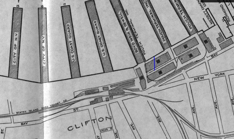
I picked a section at random, and came up with this map from Staten Island. At the top a tiny railroad system serves three piers, with no car float or external link to the outside world. And in the middle of the map is the Staten Island Rapid Transit Co depot. Still running today, and using modified New York subway cars, the map shows a compact depot for the storage and maintenance of vehicles.
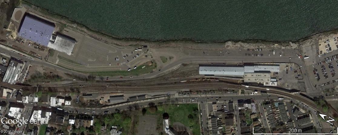
And here it is today….. No piers, but the depot has survived.

Great find. I saw on the map “Pouch Terminal” and immediately thought of Phillip Goldstein’s website. He has a page dedicated to this property:
http://members.trainweb.com/bedt/indloco/pt.html
Describing the location and also it’s connection, by rail and water, to the outside world.
Chris
LikeLike